

Hero - Interior Page Hero Module


Listicle View

Boone Greenway
The fully accessible Boone Greenway stands as proof that NC’s cities and towns are also bursting with outdoor possibilities. The 3- or 3.5-mile trek, depending on where you turn around, feels like it’s miles from civilization. But the paved path and remains of a dam in the South Fork of the New River remind hikers it’s actually nestled in a low valley between two neighborhoods. Park at Clawson-Burnley Park (a great place for a post-hike picnic) and head north for a nature-packed stroll, or head south for a shorter walk with urban flair, including several nearby restaurants.

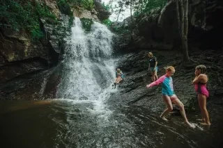
Deep Creek
Hiking along Deep Creek in Great Smoky Mountains National Park is as easy as it gets. A wide, well-maintained path follows Deep Creek — which isn’t very deep at all, just deep enough for a relaxing float on an inner tube (bring your own or rent one nearby). But the adventures are just getting started. Watch for several waterfalls up ahead. Tom Branch Falls and Indian Creek Falls are right off the trail as you follow the 4.9-mile Deep Creek Loop, but you can add a third — Juney Whank Falls — by tacking a 0.6-mile loop onto the beginning or end of your hike.

Price Lake Trail
On the Blue Ridge Parkway just a few miles from Boone, Julian Price Memorial Park has a 47-acre lake for fishing and paddling, plus a lakeside trail for a peaceful stroll. The 2.5-mile Price Lake Trail circles the lake, taking you into the woods, across creeks and along marshes via bridges and boardwalks. Bring your camera and some birding binoculars to get an up-close look at nature throughout the hike.
Check out our Guide to Birding in NC
Max Patch
Serious and novice hikers alike will enjoy what has been called “The Crown Jewel of the Appalachian Trail.” Hiking along this part of the AT leads to the top of a 4,600-foot mountain with 360-degree views of the Appalachian Mountains that won’t stop. This 350-acre tract of land was cleared and used as pasture hundreds of years ago, but today Max Patch’s lush green mountaintop is perfect for a mid-hike picnic. The 1.5-mile short loop is particularly stunning at sunset.

Upper Whitewater Falls
Sometimes it’s the shortest hikes that have the best views, and the 0.6-mile round trip hike to see Upper Whitewater Falls pays off big. How big? Whitewater Falls is the highest waterfall in the East. The trail is also paved and wheelchair-friendly.

Kuwohi and Andrews Bald
Hike the highest peak in Great Smoky Mountains National Park by making the trek to Kuwohi (previously Clingmans Dome). First “hike” to the summit via the paved half-mile trail to take in unparalleled views of North Carolina to the east, then head back to your car. Grab hiking poles and extra water — there’s a 3.5-mile round-trip hike ahead. At the end of the parking area, descend the stairs to start on the trail to Andrews Bald. What’s a bald? A high, grassy meadow found in these parts, and Andrews Bald is a beaut. Throughout spring and summer, it’s filled with blooming azaleas and rhododendron, and in the fall, the foliage color is jaw-dropping.

Glen Burney Trail
The secret: There’s a waterfall hike in downtown Blowing Rock. The details: The Glen Burney Trail leads you on a 2.2-mile jaunt into the woods and along a stream to a trio of waterfalls. It’s a short but steep hike with rocks and roots to navigate — but it’s worth the effort. From the parking area on Laurel Lane, descend all the way down to the Glen Marie Falls featuring a triple-tiered descent that plunges 75 feet and makes for dramatic photos. As you ascend, you’ll reach Glen Burney Falls, which drops 50 feet over a moss-covered rock face. Continue the climb back to civilization and stop for a rest at the Cascades, the final waterfall on this hike.

Appalachian Trail
The Appalachian Trail crosses Fontana Dam and enters Great Smoky Mountains National Park for an unforgettable — and very challenging — 72 miles along the ridgeline separating North Carolina and Tennessee. What makes it so tough? The distance, for starters. Plus the logistics of setting up backcountry campsites and transportation. Then there’s the trail itself. From Fontana Dam to Newfound Gap, it’s about a 40-mile hike with a 4,900-foot elevation gain. Eleven miles into this trek and you’ll reach the undulating ridgeline with one steep ascent and descent after another. The second section, from Newfound Gap to Davenport Gap, has 11 major climbs including a few summits of high peaks where you can catch your breath and recharge before heading on.

Devil’s Courthouse
All that's needed in a visit to Devil’s Courthouse are some sturdy walking shoes and the will to ascend 150 feet in less than a half-mile. It’s a steep and strenuous undertaking, but the short hike to this rock outcrop at Milepost 42.4 on the Blue Ridge Parkway is a gem. According to Cherokee legend, the fearsome giant Judaculla lives in the chambers beneath this rock outcropping, but to European settlers, this place looked more like where the devil himself might hold court. As fearsome as the rocks might look, when you’re on top, there’s nothing but views for days and an opportunity to bask in the glory of what you just accomplished.

Mount Mitchell
There are two ways to climb Mount Mitchell, the highest peak in the East at 6,684 feet: Drive to a parking area for a quick quarter-mile jaunt to the summit, or hike Mount Mitchell Trail for a 12-mile, round-trip hike with more twists and turns — and stories to tell. The trail starts at Black Mountain Campground and is easy to follow as it heads straight up the mountain, requiring four to six hours to climb and another three to four to descend. (Bring extra water and something more significant than a snack.) The hike through the hardwoods and patches of pine and balsam is pleasant every step of the way — just be prepared to take on around 3,700 feet in elevation gain.

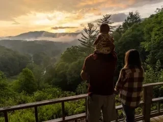
All the views, none of the effort
Climb the stairs or take the elevator to these rooftop restaurants and bars for views so captivating you’ll forget to look at the menu.
Asheville
The Montford and Capella on 9 give you the city skyline set against the surrounding mountains, making for quite the sight in any season, but an absolute stunner in fall.
Boone
The rooftop bar at the Horton Hotel offers up a look at the town, the mountains and the sunset that you can’t get anywhere else.
Bryson City
Overlook the Tuckasegee River and take in NC’s Great Smoky Mountains on the rooftop patio at Mountain Layers Brewing.
Visit Outdoor NC for additional tips on how to connect with nature and help preserve the natural beauty of our state.